Teaching Your Child About Maps and Globes – Make Understanding and Interpretation Easy

Maps and Globes are something that naturally appeal to children. I think that it appeals to their adventurous side: pirates, explorers, and all that. Teaching some simple map and globe facts can eve n when your children are very young. While they may not retain every fact, or completely comprehend things like latitude and longitude they are always learning and will build on what they know as they grow and develop.
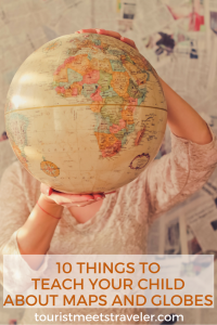
1. Difference between a map and a globe: Explain to your child in simple terms that a map is a flat drawing of the earth, while a globe is is a representation of the actual shapeof the earth.
2. Land/water: One of the simplest things to teach about a map, that even a very young child can understand is the difference between land and water on a globe or map. Identify that the brown and green masses are land and the blue represents water.
3. Latitude and Longitude: latitude runs east and west, or left and right on a map. Longitude runs north and south or top to bottom. Show your child the equator at 0° latitude that divides the northern and southern hemispheres. Then the Prime Meridian that is at 0° longitude. Using these two points on a map you can find the exact location of any place in the world.
4. Continents: Identifying the 7 continents is a great basic way of identifying other areas of the world, a good way to reinforce their memory of them is to identify each with landmarks, animals, or something similar, for example- “Here is China, this is where panda’s are from”, Here is “North America, where we are” This gives them a simple point of reference.
5. Their own location: Show them where they are in more specific detail than which continent, the country, state and if your map is detailed enough, the city or at least a general area.
6. Cardinal directions: North, South, East. And West. Demonstrate how they relate to points on a globe or map. Point to directions such as – North of the Equator, North and South America. Once they understand the basic four directions you can ask them to identify “What is East of Europe?” or “What is the southernmost continent?”
7. Oceans: Teaching your child the 5 oceans of the world is a great way to expand their map knowledge. They are- Indian, Pacific, Atlantic, Arctic, and Southern. Start with the ocean that is nearest your location, make it relevant to your child, if you have visited the beach that belongs to that ocean “Remember when we visited the beach last summer? That was part of the ___ ocean” Then work you way outward.
8. Key: Map symbols help identify various areas on a map. The symbols used will depend on whether its a map of the world or a city map. It may identify mountain ranges, or railroad tracks. Locate the Key on the maps you have available and search for each item with your child until you locate them on the map.
9. Types of maps: Whether you have many types of maps and globes on hand or you visit the library for a mini field trip show your child that there are maps of the world, of just one country, or even maps of just a specific city. Some are climate maps, some are topographical, or political. Atlas’s contain lots of different map aspects and information.
10. Scale: shows you the distance on a map in a small size, obviously life size maps and globes are not an option when traveling. 1” may represent 1 mile or 100 yards.
Make a map for you child of your backyard, neighbourhood or local park, this will give them an idea of what a map does, such as showing major landmarks, bodies of water, etc. After your child has explored a bit they may want to make their own map. Encourage their efforts with paper, crayons, and colored pencils. This is a great way to learn directions, and scale as well as building fine motor skills.